
Kem
Îles Solovki

|
|
Mer Blanche | Kem |
Îles Solovki |
|
|
Archipel des Solovki | Solovetski |
Anzer |
Bolshoï Muksalama | Malaya Maksalma | Bolshoï Zayatsky | Maly Zayatski |
|
 |
Ensemble historique, culturel et naturel des îles Solovetsky |
L’archipel près du cercle polaire: les îles Solovki |
| Localisation | ||
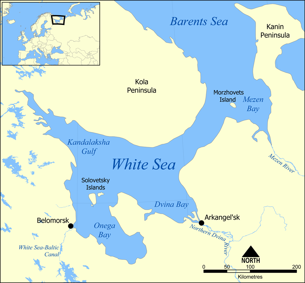
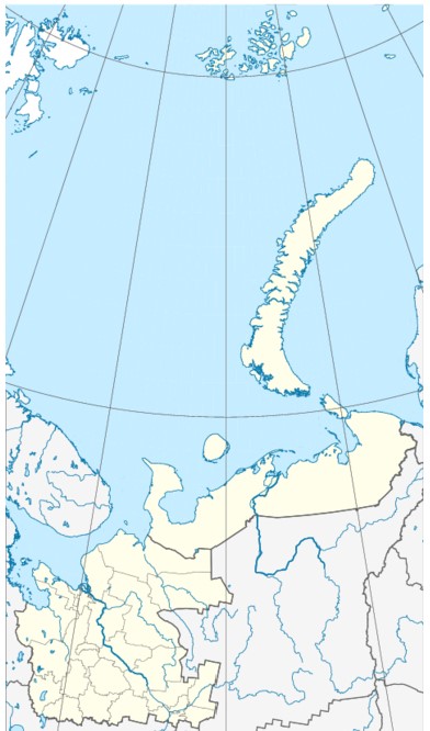
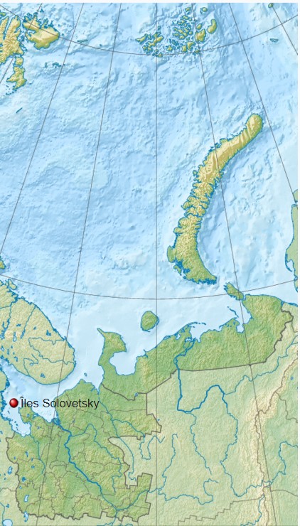
Situation : Mer Blanche - Baie Onega
|
 |
  |
| Administration - RU | |||||||||
| Pays | Statut | District fédéral | Sujet fédéral | District municipal | Région économique | Région touristique / historique/ gastronomique | Ville | Ville proche | Code OKATO |
Russie |
république | Nord-Ouest | Oblast d'Arkhangelsk | Primorsky | Kem Arkhangelsk |
||||
| Administration | |||
| Statut | Chef de l'Etat | Chef du gouvernement | Parlement |
| Géographie | |||||||
| Coordonnées - lattitude | Longitude | Atltitude | Superficie | Superficie en eau | Cours d'eau | Climat | Fuseaux horaires |
| 00° 00 00" N | 00° 00 00" E | 347 km² | continental nord | ||||
| Climat | |||||||||||||||||||||||||||||||||||||||||||||||||
|
|||||||||||||||||||||||||||||||||||||||||||||||||
|
|
||||||||||||||||||||||||||||||||||||||||||||||||
| Démographie - Population | |||||||
| Population | Densité | Gentilé | Groupes ethniques | Langues officielles | Langues administratives | Langues locales | Religions |
| 900 | |||||||
| Histoire | ||||||
| Fondation | Statut | Anciens noms | ||||
| Les îles principales | |||||
| Solovetsky | |||||
| 246 km² | |||||
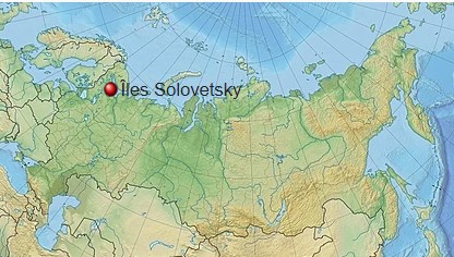
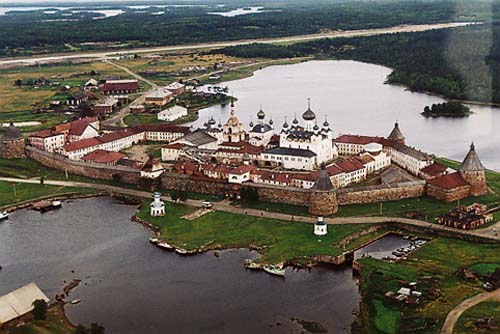
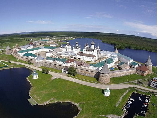
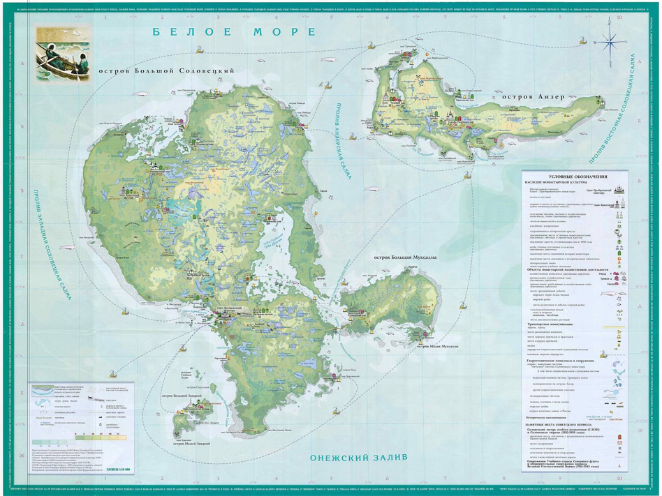
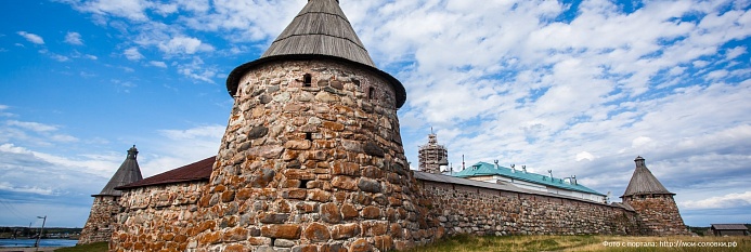
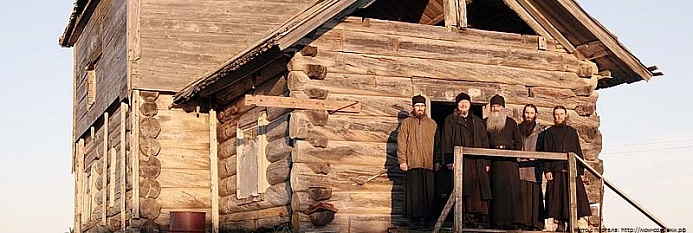
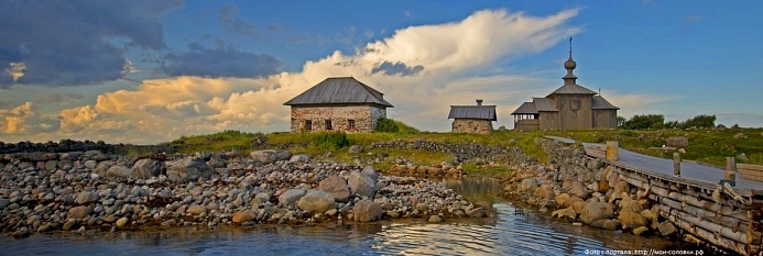
Les îles Solovetsky ( Pomorsk. Solovki , carélienne. Solokka des Sami Suollek - «îles») est un archipel de la mer Blanche à l'entrée de la baie d'Onega . L'archipel comprend également plus de 100 petits îlots. Les îles sont administrativement subordonnées au district municipal Primorsky de la région d'Arkhangelsk ( colonie rurale de Solovetsky ). L'archipel de Solovetsky, ainsi que la zone d'eau de cinq kilomètres de la mer Blanche, sont inclus dans une zone spécialement protégée - l'institution fédérale d'État " Solovetsky State Historical, Architectural and Natural Museum-Reserve ". Il y a une zone strictement protégée sur l'île Bolchoï Solovetsky [ clarifier ] . L'attraction principale et le centre spirituel des îles [ source non précisée 487 jours ] est le monastère stavropégique de Solovetsky .
|
|||||
| Description |
Les îles Solovki connues également sous les noms de Solovetski ou Solovetsk, forment un archipel au nord-ouest de la Russie dans la mer Blanche. Situées dans la baie d'Onega, les îles sont administrées par l'oblast d'Arkhangelsk. Leur superficie totale est de 347 km2 pour une population de 968 habitants en 2002. L'archipel comprend six îles dont les plus grandes sont Solovetski, Anzerski, Bolchaïa Mouksalma et Malaïa Mouksalma. L'archipel est célèbre pour le monastère Solovetski du xve siècle et son ancien camp de travail soviétique, précurseur de l'organisation du Goulag. |
Solovki se révèle dans plusieurs dimensions
|
 |
 |
 |
| Les îles http://visit-solovki.ru/ | |
Bolshoy Solovetsky Island Bolshoy Solovetsky Island or simply Solovetsky Island is the biggest island of the Solovetsky Islands archipelago in the White Sea. The island is home to Solovetsky Monastery, a medieval monastery and a fortress included in the World Heritage list.
|
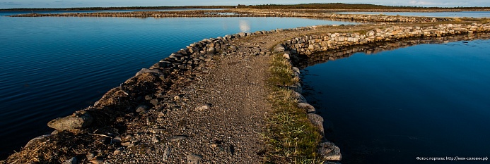
Bolshaya Muksalma Island Bolshaya Muksalma is one of the Solovetsky Islands. Bolshaya Muksalma is situated to the east of Bolshoy Solovetsky Island and is separated from it by two straits: Severnye Zheleznye Vorota and Yuzhnye Zheleznye Vorota (literally translated as Northern and Southern Iron Gates). The Yuzhnye Zheleznye Vorota Strait is crossed by a dam which was built by the monks of Solovetsky Monastery between 1865 and 1871 and now connects the two islands. |
 |
 |
Anzer Island Anzer Island is the second largest island of the Solovetsky archipelago, it's located 5 kilometers north-east of the Bolshoy Solovetsky Island. In Vepsian the name of the island means "very elongated island." |
Malaya Muksalma Island Malaya Muksalma is the smallest of the six major islands of the Solovki archipelago. In 1828 the boulder dam was built, connecting it with the island of Bolshaya Muksalma. Construction of the dam gave a powerful impetus to the development of the fishing and trapping business on the island. |
 |
 |
Bolshoy Zayatsky Island Bolshoy Zayatsky Island is located near the Bolshoy Solovetsky Island, five kilometers away from the monastery. It's small. But here, in a small area, hundreds of preserved monuments of the past life still remain undisturbed, like nowhere else in our country. They belong to two cultures - the primitive society and medieval Christian society. |
Malyi Zayatsky Island
|
 |
 |
| Services, facilités | ||||||||||||
Audioguide |
Langues |
Wifi |
Photo - Vidéo |
Shop |
Consigne |
Vestiaire |
Cafetaria |
ATM |
Visite guidée |
|||
| Sites web | |
| Wikivoyage EN - RU | |
 |
ArtelTroika |
| https://totamtotut.ru/2020/11/30/kak-dobratsya-do-solovkov-na-samolete-poezde-avtomobile-ili-avtobuse/ | |